17th century Haudenosaunee combs. "Antler Hair Combs," Deyohahá:ge:- Indigenous Knowledge Centre
Reading an object
combs created for personal decoration
visible to community
Indigenous people unmarked, "normal," Dutch exotic but not supernatural
Dutch marked with buttons and hatchets, objects of trade
Dutch known as "cloth people"
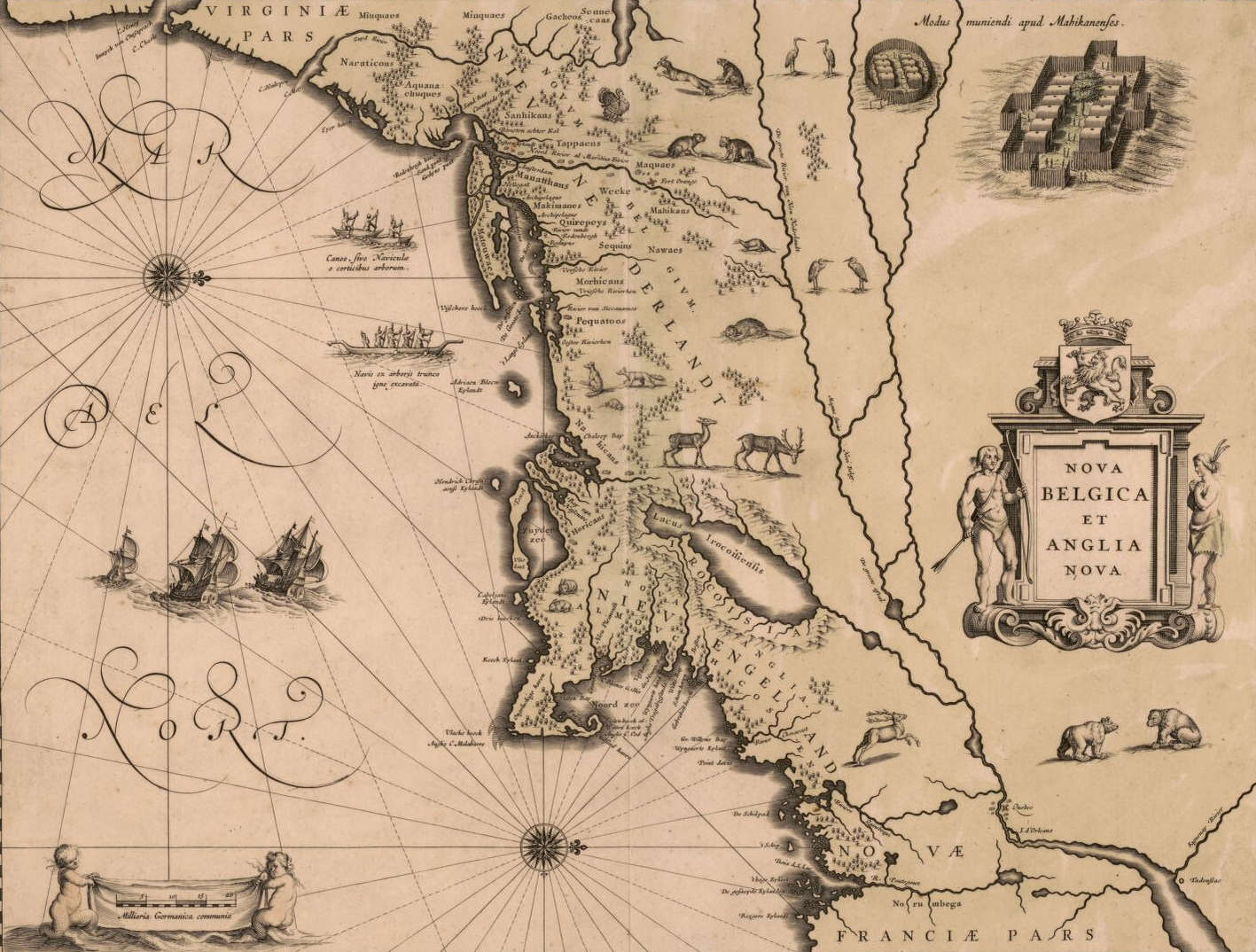
Reading maps
Who was the assumed audience?
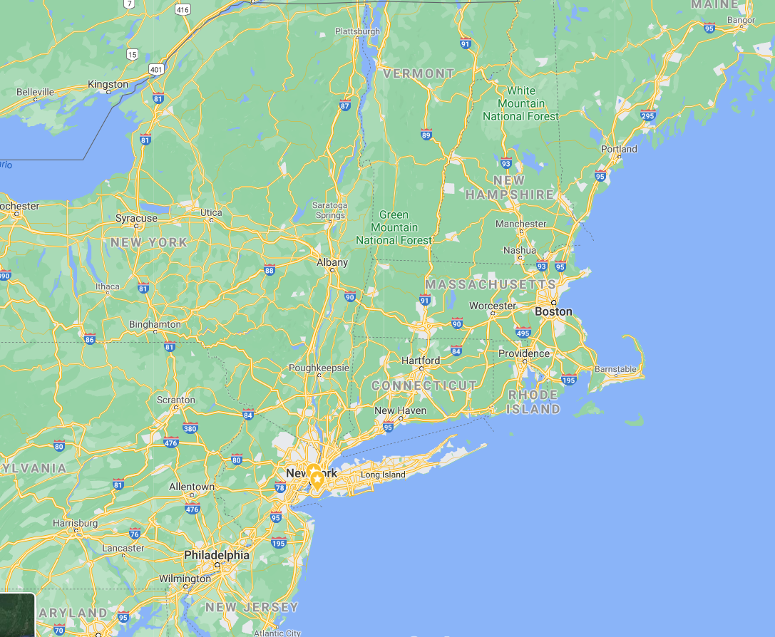
Why was the coast oriented that way? Where was the "reader" of this map standing?
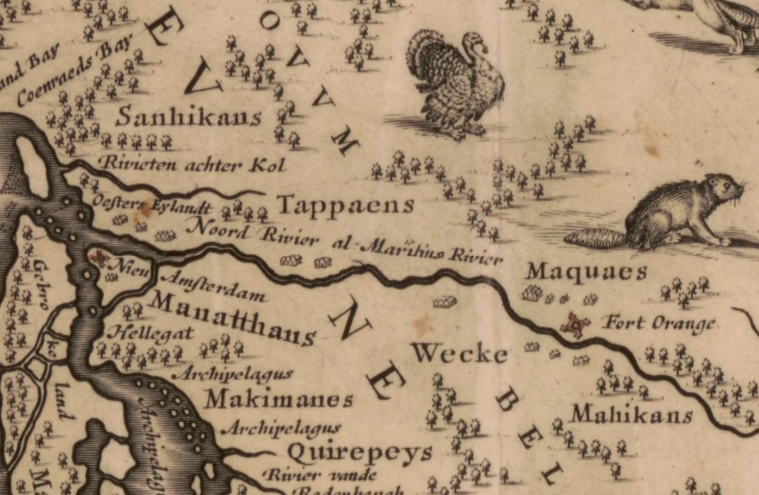
What was pictured? How were Indigenous communities shown?
Who controlled this territory?
US Northeast 2022
Google Maps
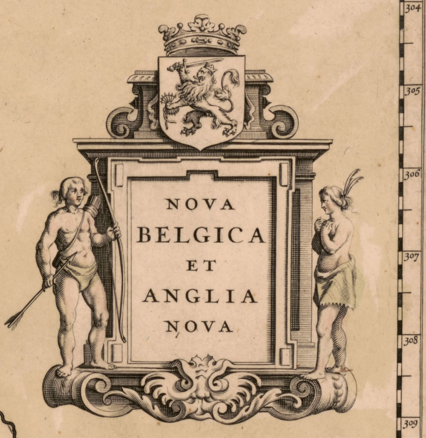
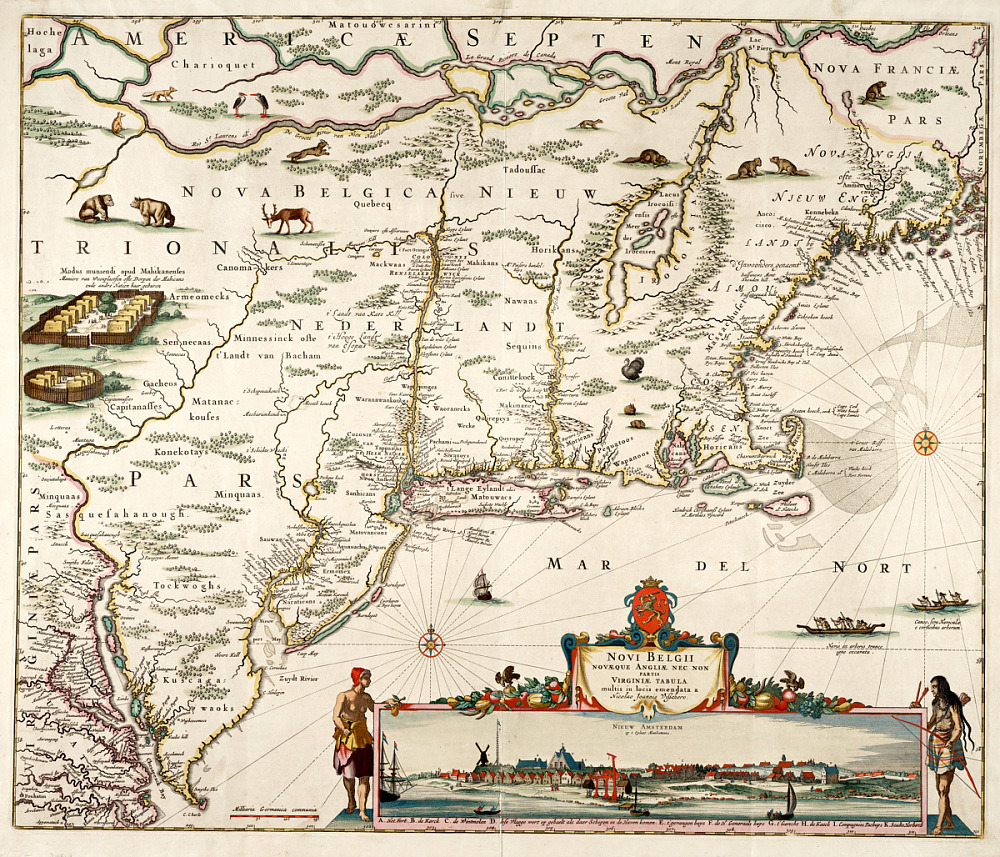
NOVA BELGICA ET ANGLIA NOVA, 1635
Blaeu, Willem Janszoon, Cartographer. Nova Belgica et Anglia Nova. [Amsterdam: Willem Janszoon Blaeu, ?, 1630] Map. https://www.loc.gov/item/2017585967/.
Who was the audience?
"New Netherland and New England"
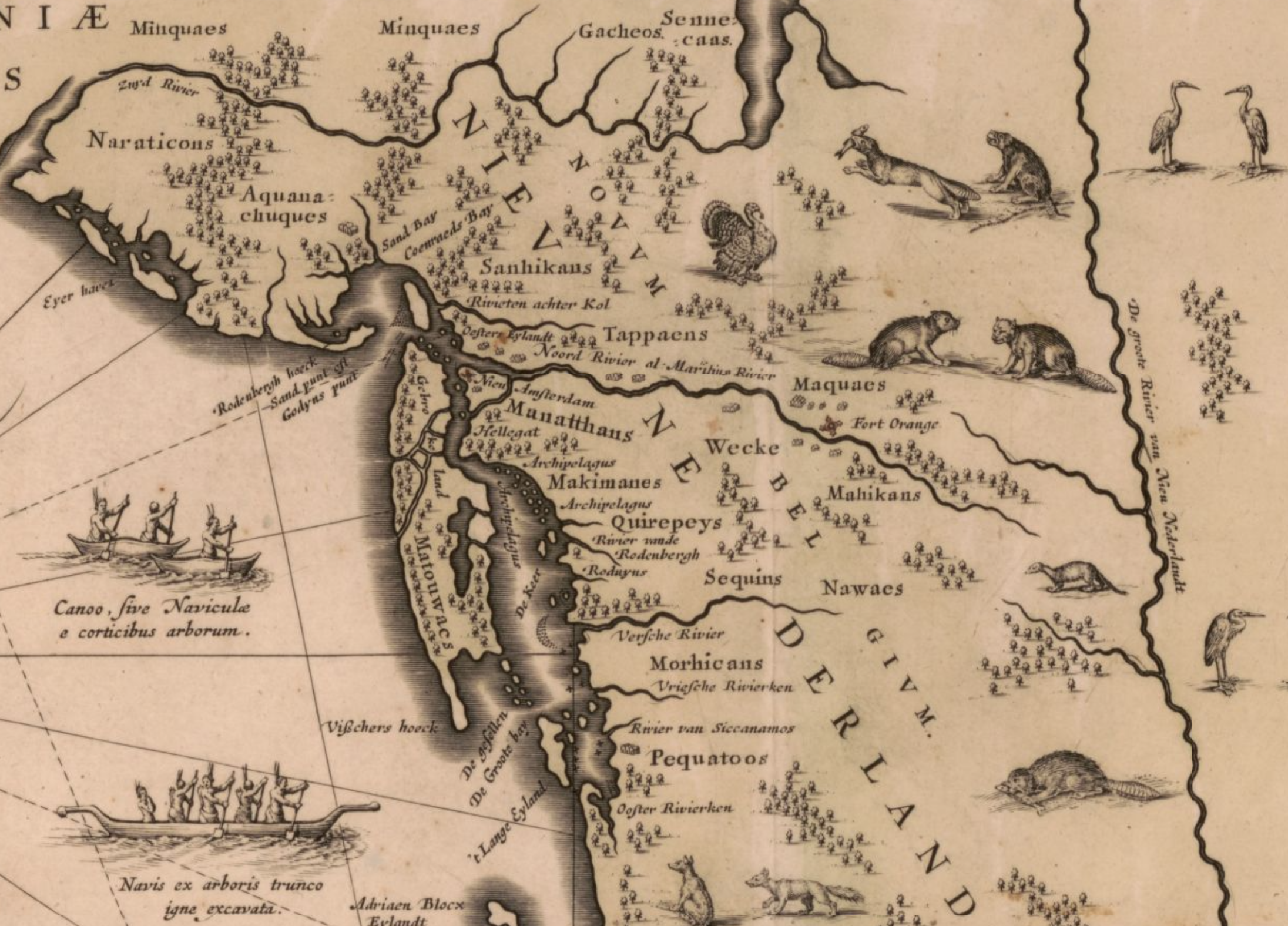
Where was the reader standing? What was labeled?
"Canoe made from bark and from the hollowed out trunk of a tree"
How were Indigenous communities shown?
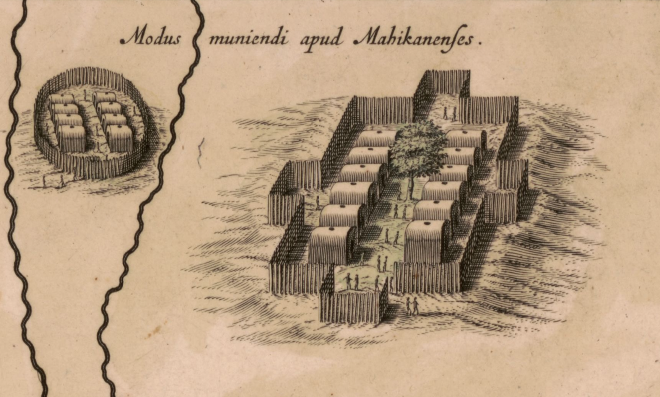
"Method of protecting themselves from the Mahican"
 "John Guy's Encounter with the Beothuks, 1612," Mattheus Merian, 1628 https://collections.mun.ca/digital/collection/cns_images/id/35/
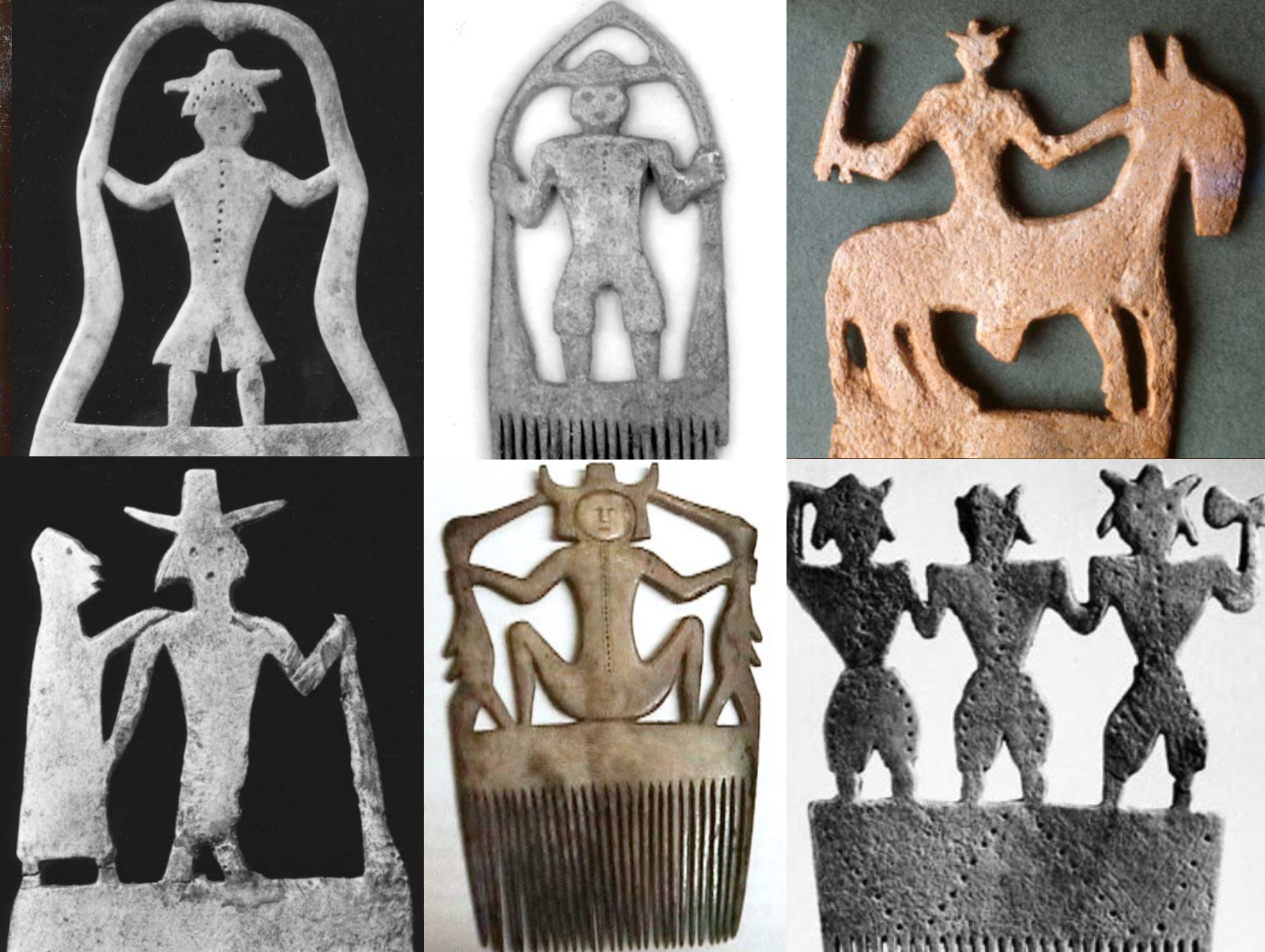 17th century Haudenosaunee combs. "Antler Hair Combs," Deyohahá:ge:- Indigenous Knowledge Centre